Saturday, July 06, 2013

Canoe trip along the Isar

Did something a little different yesterday:  a new friend, Norbert, has a canoe, and we went down the Isar in it from about midway between Bad Tölz and Lenggries to Kloster Schäftlarn.  The distance on the water was a little more than 35km, and we padded for about four hours.  But I'm only a little stiff today (despite it being more than a couple of decades since my last canoeing trip!) because we were in no great hurry, and the river was high (and so fairly fast).

We stopped for lunch on a gravel bank in the middle of the river (thereby avoiding the mosquitoes... because they don't seem to like fly over water... who are much more numerous than usual this summer due to the massive flooding in early June) and grilled sausages, which we ate with Obatzda, Brezen, beer, and potato salad.

There weren't very many other people on the water -- we only saw three groups, all commercial white-water rafting trips in rubber boats -- probably because the weather wasn't very good when we set out in the morning (heavy clouds and light rain), but also perhaps because the water looked dauntingly fast-flowing, and, of course, it was a weekday.  But the clouds soon thinned out and the temperatures were fairly warm, so it turned out to be a perfect day for canoeing.

The Isar is a suprising river:  despite flowing through busy Bavaria, you see few signs of civilization.  In fact, along the 30km from Bad Tölz to Kloster Schäftlarn there are only two bridges, and you only see two groups of buildings:  at Einöd (where we stayed our first night on the H2H) and Schlederloh (home!).  Here's a picture of our house from the river (we pulled over here, to take the camera out of its waterproof bag... which by implication explains the paucity of other pictures):


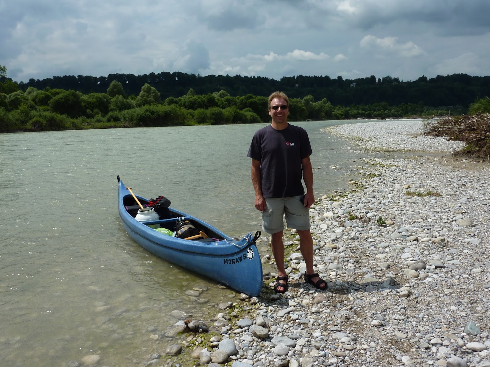
And here is Norbert, with his excellent canoe:


I've been meaning to canoe down the Isar for a number of years now... but not having a canoe (and, let's face it, being a bit of a lazy bugger) never got around to it.  However, there is minor consolation in the fact that this was a particularly interesting time to be on the river.  As part of the major flooding mentioned above, the Isar did some major damage to its banks (in fact I saw several large trees fall in to the river while sitting at my desk in Schlederloh!), and so there were huge piles of trees and branches on all sides, as well as in mid-stream.  In some places the banks had been scoured clean of vegetation and you could see the underlying rock... sometimes limestone, sometimes a conglomerate called Nagelfluh.  For someone with an interest in both extreme weather events and geology... a bonus!


Sunday, June 30, 2013

Automatic reminder feature for new posts

I'm going to send an email to most (ideally all, but I'm sure I'll forget someone... sorry!) people who might be interested in reading about my Luberon hike yesterday, but it occurs to me that many of you might not know that you can sign up for an automatic email reminder whenever there I do a new post.  To do this, go to the blog (well, you are probably here now), and then scroll down until you see this on the left hand side:

Subscribe to
Posts [Atom]

Click on the word Atom and you'll be taken to your default email program and you'll be asked if you want to add a "feed" for my blog.  Click on "Add" (or "OK" or "Confirm" or whatever your email program shows you) and you are done!  Henceforth you'll be notified whenever there is a new post.

And henceforth I won't bother you (especially those of you who aren't interested in my escapades) with emails about new blog posts!

A double-crossing of the Luberon

Trying to stay in shape, or maybe get in shape, for my upcoming Appenzell hike, I crossed the nearby Luberon mountain from Oppède le Vieux to the entrance of the Regalon gorge... and then turned around and hiked back.  In total, about 5.75 hours of hiking, 1040m up (and down), and 22km, across very rough and stony terrain (which made it considerably more tiring than the same distance etc. would have been on most Alpine trails I've hiked).

From a fitness perspective, the results were mixed:  my legs feel fine today, so that's ok, but I ran out of steam on the second climb yesterday.  Still, overall I did the hike in about 70% of the DAV estimate... and the heat (it was 29C) undoubtably played somewhat of a role in my dog-like panting when coming back up in the mid-afternoon.  On the other hand, the hike in Appenzell will start at 800m and go up to 2500m... whereas the highest spot I reached on the Luberon was 706m.  And there's a lot less oxygen at 2500m than there is at 700m.  So, we'll see.

Beautiful hike, though.  Here are some pictures.  First the view from the top looking south towards a beautiful promontory:


Then the view down from the promontory to the Regalon gorge (that crack in the distance near the lake):


And now a bunch of photos taken in the gorge itself.  Here's the dramatic entrance:


Starts off wide:


Goes through a cave, or I guess I should probably call it a tunnel:


Then things got a little tight:


And stayed that way for a bit:


In the photo below, those are boulders that got stuck when they fell into the gorge:


At times there was some scrambling required:


 And sometimes I had to scramble at an angle:


And here's the end of the gorge:


Finally, here is yours truly, back up on the promontory after the second climb (and looking sweaty but pleased with himself!):


Back to Bavaria in a couple of days, some acclimatization hikes in the Bavarian Alps, and then it will be off to Switzerland on the 11th of July.  I'll blog the trip, of course....