Just the three of us in the bunkroom at Schaefler last night, and neither Kristof nor Corinna snore, so we all slept well. With the weather and the forecast once again perfect, we saw no reason to rush off, and had a leisurely breakfast outside on the terrace before starting out shortly after 9.
Yesterday's hike had been tiring, with over 1700m of ascent, but my overall level of hiking fitness seems to be excellent at the moment: I had no soreness and my legs didn't feel tired. No doubt the fact that we boot-skied a lot of the downhill helped too. Just as well: today's hike was going to have us descend over 1800m... in addition to, of course, a fair amount of uphill!
The first stretch was 800m of at times near vertical descent... I'll post a couple of pictures, but I'm not sure they'll do the steepness justice. It's an interesting way to start a day. We then left most of the weight in our packs at the Berggasthof Forelle, where we would be staying the night, and hiked on.
The next stretch took us up to and along a very nice balcony trail overlooking the valley from the side opposite Schaefler, and ending at the Meglisalp hamlet where we had lunch (for me a very satisfying Chaeserösti -- cheese on grated potatoes). Shortly after 2PM we were back on the trails, climbing up to what was billed as an Alpine ridge walk along the top of the cliffs opposite Schaefler and Aescher.
Most of the trails we go along are classified as mountain walking paths (Bergwanderwege), which are marked red and white and well maintained and secured. Alpine walking paths are marked blue and white and are typically unsecured... and this was the case here. I must confess that I felt a little exposed at times on the ridge, but since the weather was near perfect (sunny, no wind), and the sheep we passed seemed to be unconcerned, I decided not to worry. When, as we enjoyed another of Kristof's mountain espressos, a couple of hikers passed us coming the other way along the trail... and they looked less experienced and less well outfitted than we were... my relaxation was complete.
The views in both directions were stunning... an absolutely superb hike... and once again a tremendously varied palette of landscapes and trail types. It's a gorgeous region here... when the weather is good... and I suspect I'll be back again soon.
At the end of the day we descended another 800 plus meters back to our Berggasthaus, arriving with legs that felt somewhat the worse for wear, but nevertheless much better than I would have guessed given the gruelling nature of the last couple of days. Proof? I had no issues going up and down the stairs to my room (yep... I'm in a room here :-). A nice dinner, another game (Seven Wonders), delightful conversation, and off to bed. Tomorrow's a free day... at least for me... and though I might go out for a short walk, for the most part I'll take it easy, do a few chores, and let my legs recover. Gabi arrives tomorrow, with fresh legs, and there are more long hikes planned (to begin with, back up to the Säntis peak, via a different route).
I hear that there is WiFi here, so perhaps I'll be able to send this off tomorrow. And there are electrical outlets in my room, so I'll be able to recharge iphone and ipad! Bliss.
Sent from my iPad
Sunday, July 14, 2013
Appenzell Hike -- Day 2
Nice evening last night at Hotel Aescher. After dinner, which I had early by myself, I went up to the bunkroom for a fleece and found there a German couple from the Bodensee. We chatted a bit and later I sat with them at an outside table as the sun went down, the views got better and better (as the clouds thinned out), and a dessert of sinful appearance was brought and consumed (ahem, by me).
Before then, however, I went for a walk. Just a short one -- up to the Wildkirchli, an open-air altar with pews for a congregation of a hundred set into a cave in the same rock ridge that shelters the hotel, and beyond it 100m through another cave to the other side of the ridge for views to the north and east over the hills and dales of the Appenzeller land.
Around 9:30 I went up to bed, read for a while, and then went to sleep... sort of. Apparently this was one of the first nice evenings this summer, and the locals were out in force... and clearly enjoying themselves immensely. There were 70-80 outside... and around 100 inside... and the noise level was high. For some reason, however, people partying when I'm trying to fall asleep doesn't bother me... but the thunderous snoring of the otherwise charming German guy in the room, to which I awoke a couple of hours later, did. Ah well, that's bunkrooms for you. Earplugs in, pillow and blankets wrapped around my head, and eventually I went back to sleep.
The morning dawned bright and clear... not a cloud in the sky. And warm... I was outside at 7:30 with a light fleece and considered taking it off. Not bad for 1450m. At 8:15 Kristof and Corinna appeared and we ate breakfast together with the couple from the Bodensee. Around 9 we set off, hiking first about 500m up to the Schaefler mountain inn, where we left a large part of the contents of our packs (we are staying here tonight), and then up to the Säntis peak.
It was a beautiful hike... very varied and with great views much of the time (although fairly soon there were convection clouds caused by rising humid air). We walked along knife-edged ridges, traversed grassy slopes strewn with flowers (many of which were new to me), scrambled over stony scree, and increasingly, the higher we got, stomped across snow fields. The last hour or so we were on snow in sun almost all the time, culminating in an exhausting and hot slog up a steep nève and then a near vertical klettersteig up to the peak. We got there at 13:40, without having stopped for lunch... and I was running on fumes.
A bratwurst with rösti quickly solved the hunger problem, and we enjoyed the sun and views for a while before considering how to go back down. Kristof has a special relationship with snow... there's always snow when we hike together... so he wanted to boot-ski down, and after close inspection of the map and the slope (from above), I let myself be persuaded. I've boot-skied before, and it's a great way to shed altitude quickly and without much effort, but in the past I've done it only on slopes I know... and we'd be going down a different one from the one we had come up. But all went well and we dropped some 800m in about 45 minutes (punctuated by frequent stops to enjoy the stunning views and, once, for an espresso that Kristof prepared with his portable cooker :-).
One final climb of 400m or so and we were back at the Schaefler hut just after 6PM... a long day, but a very good one. We ate dinner outside until the sun went behind the mountain top, then went inside and played a game while listening to the kids of a local family "entertain" everyone with a sort of slow, doleful, and occasionally off-tune, multi-voiced yodel that is apparently typical for the region. Then this blog, and now... we are off to bed. Got a long hike ahead of us tomorrow!
Sent from my iPad
Sent from my iPad


Appenzell Hike -- Day 1
Not too much hiking today... just a couple of hours at the end of the afternoon... but first things first. I left Icking in the early morning, with a plan, suggested by the Deutsche Bahn, that had me taking 6 different trains on the way to Wasserauen, the end of the line in the Appenzeller Land. Due to a 10 minute delay on the second leg (an ICE from Munich to Ulm), 6 trains became 10 and 7 hours became 8... for a trip that would take at most 3 hours by car. On the one hand it is great that you can get almost anywhere in Europe with public transportation. On the other hand, >2x the time it would take in a car is a little lame. Still, I did get to spend a half an hour in Appenzell... a charming little old town... so there was some compensation.
Then came what was supposed to be a 2 hour hike up to the Hotel Aescher. I intended to go slowly, in order to avoid sweating, because Aescher has no showers... and I did go slowly, or at least I wasn't breathing too hard, but it was humid and I sweated anyway. And somehow "slow" only took an hour and 25 minutes. Not quite sure what I did wrong (other than the obvious... going too fast). I'll try to do better tomorrow... because, with between 1300 and 1700m climbing to do (depending upon the route taken), if I don't go at a reasonable pace, I'm going to bonk!
The weather today, by the way, was a little cloudy, but no rain and warm. And the forecast for the next week: aside from a possible shower or two, there is only one symbol on the weather forecast webpage: sun. Because of that, the hotel is full this evening... and I expect there will be many people on the trails over this weekend. But given the alternative (bad weather, empty trails), I'll take it.
And Hotel Aescher? As beautiful, and beautifully situated, as advertized. An old wooden building, nestled under an overhanging cliff, with wonderful views across the valley several hundred meters below to the cliffs rising to over 2000m on the other side. Stunning. Many thanks to Madeleine for sending me the photo of the hotel that led to the planning of this trip! Now, if I can only convince her at some point to come along as well :-).
Kristof and Corinna will arrive tomorrow morning ... and then the real hiking will begin!
PS No WiFi here... it may be a while before I can post this to the blog.
Sent from my iPad
Then came what was supposed to be a 2 hour hike up to the Hotel Aescher. I intended to go slowly, in order to avoid sweating, because Aescher has no showers... and I did go slowly, or at least I wasn't breathing too hard, but it was humid and I sweated anyway. And somehow "slow" only took an hour and 25 minutes. Not quite sure what I did wrong (other than the obvious... going too fast). I'll try to do better tomorrow... because, with between 1300 and 1700m climbing to do (depending upon the route taken), if I don't go at a reasonable pace, I'm going to bonk!
The weather today, by the way, was a little cloudy, but no rain and warm. And the forecast for the next week: aside from a possible shower or two, there is only one symbol on the weather forecast webpage: sun. Because of that, the hotel is full this evening... and I expect there will be many people on the trails over this weekend. But given the alternative (bad weather, empty trails), I'll take it.
And Hotel Aescher? As beautiful, and beautifully situated, as advertized. An old wooden building, nestled under an overhanging cliff, with wonderful views across the valley several hundred meters below to the cliffs rising to over 2000m on the other side. Stunning. Many thanks to Madeleine for sending me the photo of the hotel that led to the planning of this trip! Now, if I can only convince her at some point to come along as well :-).
Kristof and Corinna will arrive tomorrow morning ... and then the real hiking will begin!
PS No WiFi here... it may be a while before I can post this to the blog.
Sent from my iPad
Saturday, July 06, 2013
Canoe trip along the Isar
Did something a little different yesterday: a new friend, Norbert, has a canoe, and we went down the Isar in it from about midway between Bad Tölz and Lenggries to Kloster Schäftlarn. The distance on the water was a little more than 35km, and we padded for about four hours. But I'm only a little stiff today (despite it being more than a couple of decades since my last canoeing trip!) because we were in no great hurry, and the river was high (and so fairly fast).
We stopped for lunch on a gravel bank in the middle of the river (thereby avoiding the mosquitoes... because they don't seem to like fly over water... who are much more numerous than usual this summer due to the massive flooding in early June) and grilled sausages, which we ate with Obatzda, Brezen, beer, and potato salad.
There weren't very many other people on the water -- we only saw three groups, all commercial white-water rafting trips in rubber boats -- probably because the weather wasn't very good when we set out in the morning (heavy clouds and light rain), but also perhaps because the water looked dauntingly fast-flowing, and, of course, it was a weekday. But the clouds soon thinned out and the temperatures were fairly warm, so it turned out to be a perfect day for canoeing.
The Isar is a suprising river: despite flowing through busy Bavaria, you see few signs of civilization. In fact, along the 30km from Bad Tölz to Kloster Schäftlarn there are only two bridges, and you only see two groups of buildings: at Einöd (where we stayed our first night on the H2H) and Schlederloh (home!). Here's a picture of our house from the river (we pulled over here, to take the camera out of its waterproof bag... which by implication explains the paucity of other pictures):

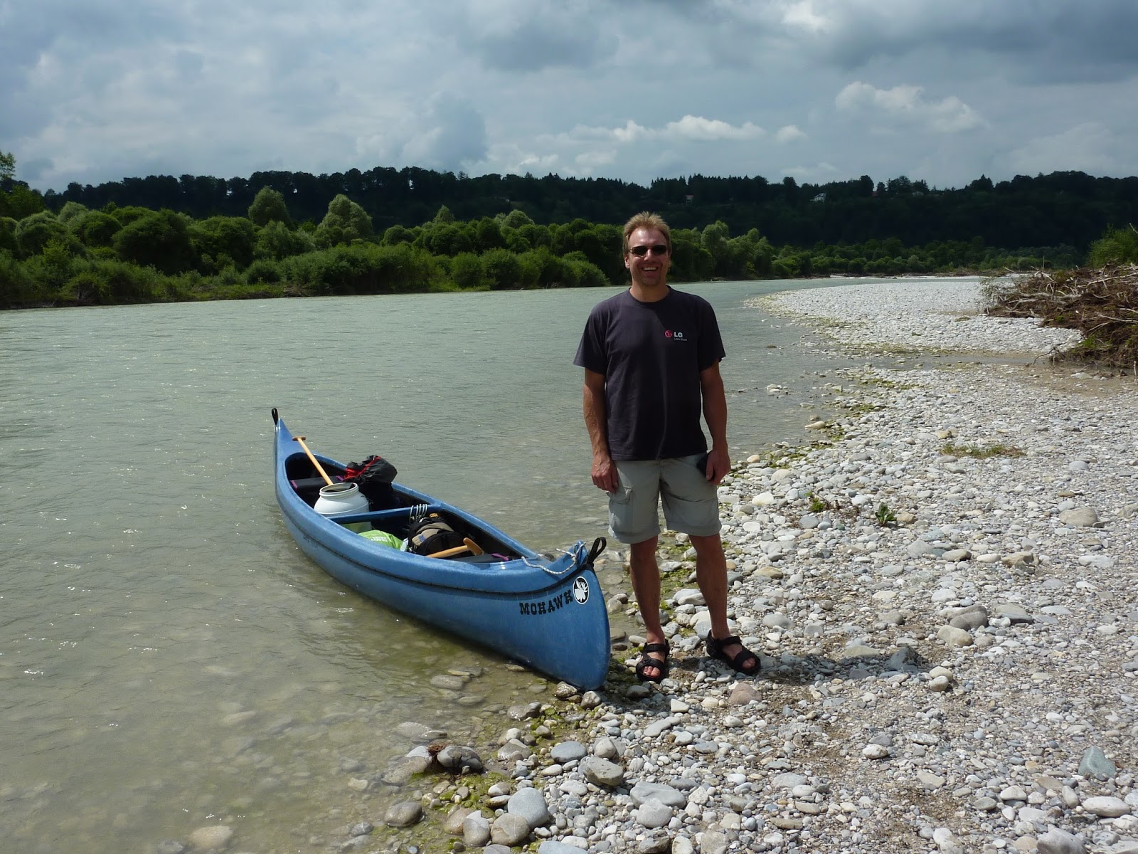
And here is Norbert, with his excellent canoe:

I've been meaning to canoe down the Isar for a number of years now... but not having a canoe (and, let's face it, being a bit of a lazy bugger) never got around to it. However, there is minor consolation in the fact that this was a particularly interesting time to be on the river. As part of the major flooding mentioned above, the Isar did some major damage to its banks (in fact I saw several large trees fall in to the river while sitting at my desk in Schlederloh!), and so there were huge piles of trees and branches on all sides, as well as in mid-stream. In some places the banks had been scoured clean of vegetation and you could see the underlying rock... sometimes limestone, sometimes a conglomerate called Nagelfluh. For someone with an interest in both extreme weather events and geology... a bonus!
We stopped for lunch on a gravel bank in the middle of the river (thereby avoiding the mosquitoes... because they don't seem to like fly over water... who are much more numerous than usual this summer due to the massive flooding in early June) and grilled sausages, which we ate with Obatzda, Brezen, beer, and potato salad.
There weren't very many other people on the water -- we only saw three groups, all commercial white-water rafting trips in rubber boats -- probably because the weather wasn't very good when we set out in the morning (heavy clouds and light rain), but also perhaps because the water looked dauntingly fast-flowing, and, of course, it was a weekday. But the clouds soon thinned out and the temperatures were fairly warm, so it turned out to be a perfect day for canoeing.
The Isar is a suprising river: despite flowing through busy Bavaria, you see few signs of civilization. In fact, along the 30km from Bad Tölz to Kloster Schäftlarn there are only two bridges, and you only see two groups of buildings: at Einöd (where we stayed our first night on the H2H) and Schlederloh (home!). Here's a picture of our house from the river (we pulled over here, to take the camera out of its waterproof bag... which by implication explains the paucity of other pictures):

And here is Norbert, with his excellent canoe:
I've been meaning to canoe down the Isar for a number of years now... but not having a canoe (and, let's face it, being a bit of a lazy bugger) never got around to it. However, there is minor consolation in the fact that this was a particularly interesting time to be on the river. As part of the major flooding mentioned above, the Isar did some major damage to its banks (in fact I saw several large trees fall in to the river while sitting at my desk in Schlederloh!), and so there were huge piles of trees and branches on all sides, as well as in mid-stream. In some places the banks had been scoured clean of vegetation and you could see the underlying rock... sometimes limestone, sometimes a conglomerate called Nagelfluh. For someone with an interest in both extreme weather events and geology... a bonus!
Sunday, June 30, 2013
Automatic reminder feature for new posts
I'm going to send an email to most (ideally all, but I'm sure I'll forget someone... sorry!) people who might be interested in reading about my Luberon hike yesterday, but it occurs to me that many of you might not know that you can sign up for an automatic email reminder whenever there I do a new post. To do this, go to the blog (well, you are probably here now), and then scroll down until you see this on the left hand side:
Subscribe to
Posts [Atom]
Click on the word Atom and you'll be taken to your default email program and you'll be asked if you want to add a "feed" for my blog. Click on "Add" (or "OK" or "Confirm" or whatever your email program shows you) and you are done! Henceforth you'll be notified whenever there is a new post.
And henceforth I won't bother you (especially those of you who aren't interested in my escapades) with emails about new blog posts!
Subscribe to
Posts [Atom]
Click on the word Atom and you'll be taken to your default email program and you'll be asked if you want to add a "feed" for my blog. Click on "Add" (or "OK" or "Confirm" or whatever your email program shows you) and you are done! Henceforth you'll be notified whenever there is a new post.
And henceforth I won't bother you (especially those of you who aren't interested in my escapades) with emails about new blog posts!
A double-crossing of the Luberon
Trying to stay in shape, or maybe get in shape, for my upcoming Appenzell hike, I crossed the nearby Luberon mountain from Oppède le Vieux to the entrance of the Regalon gorge... and then turned around and hiked back. In total, about 5.75 hours of hiking, 1040m up (and down), and 22km, across very rough and stony terrain (which made it considerably more tiring than the same distance etc. would have been on most Alpine trails I've hiked).
From a fitness perspective, the results were mixed: my legs feel fine today, so that's ok, but I ran out of steam on the second climb yesterday. Still, overall I did the hike in about 70% of the DAV estimate... and the heat (it was 29C) undoubtably played somewhat of a role in my dog-like panting when coming back up in the mid-afternoon. On the other hand, the hike in Appenzell will start at 800m and go up to 2500m... whereas the highest spot I reached on the Luberon was 706m. And there's a lot less oxygen at 2500m than there is at 700m. So, we'll see.
Beautiful hike, though. Here are some pictures. First the view from the top looking south towards a beautiful promontory:

Then the view down from the promontory to the Regalon gorge (that crack in the distance near the lake):

And now a bunch of photos taken in the gorge itself. Here's the dramatic entrance:

Starts off wide:

Goes through a cave, or I guess I should probably call it a tunnel:

Then things got a little tight:

And stayed that way for a bit:

In the photo below, those are boulders that got stuck when they fell into the gorge:

At times there was some scrambling required:

And sometimes I had to scramble at an angle:


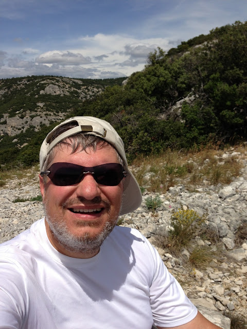
Finally, here is yours truly, back up on the promontory after the second climb (and looking sweaty but pleased with himself!):
Back to Bavaria in a couple of days, some acclimatization hikes in the Bavarian Alps, and then it will be off to Switzerland on the 11th of July. I'll blog the trip, of course....
From a fitness perspective, the results were mixed: my legs feel fine today, so that's ok, but I ran out of steam on the second climb yesterday. Still, overall I did the hike in about 70% of the DAV estimate... and the heat (it was 29C) undoubtably played somewhat of a role in my dog-like panting when coming back up in the mid-afternoon. On the other hand, the hike in Appenzell will start at 800m and go up to 2500m... whereas the highest spot I reached on the Luberon was 706m. And there's a lot less oxygen at 2500m than there is at 700m. So, we'll see.
Beautiful hike, though. Here are some pictures. First the view from the top looking south towards a beautiful promontory:

Then the view down from the promontory to the Regalon gorge (that crack in the distance near the lake):

And now a bunch of photos taken in the gorge itself. Here's the dramatic entrance:

Starts off wide:

Goes through a cave, or I guess I should probably call it a tunnel:

Then things got a little tight:

And stayed that way for a bit:

In the photo below, those are boulders that got stuck when they fell into the gorge:

At times there was some scrambling required:


And here's the end of the gorge:


Back to Bavaria in a couple of days, some acclimatization hikes in the Bavarian Alps, and then it will be off to Switzerland on the 11th of July. I'll blog the trip, of course....
Sunday, June 02, 2013
Photos
Just a reminder… if you double click on them you get much larger versions with much better detail!
Subscribe to:
Posts (Atom)